SAP and GIS often describe the same physical world through different operating lenses. SAP focuses on assets, maintenance, costs, materials and work. GIS focuses on location, networks, topology, spatial relationships and map-based decisions. A useful integration does not force one system to imitate the other; it gives each system a clear role and connects the workflows between them.
A blueprint is valuable when it resolves decisions that delivery teams would otherwise rediscover through defects. It should describe ownership, identity, workflow, synchronisation, security, failure handling and change governance in enough detail to guide implementation and operations.
Blueprint at a glance
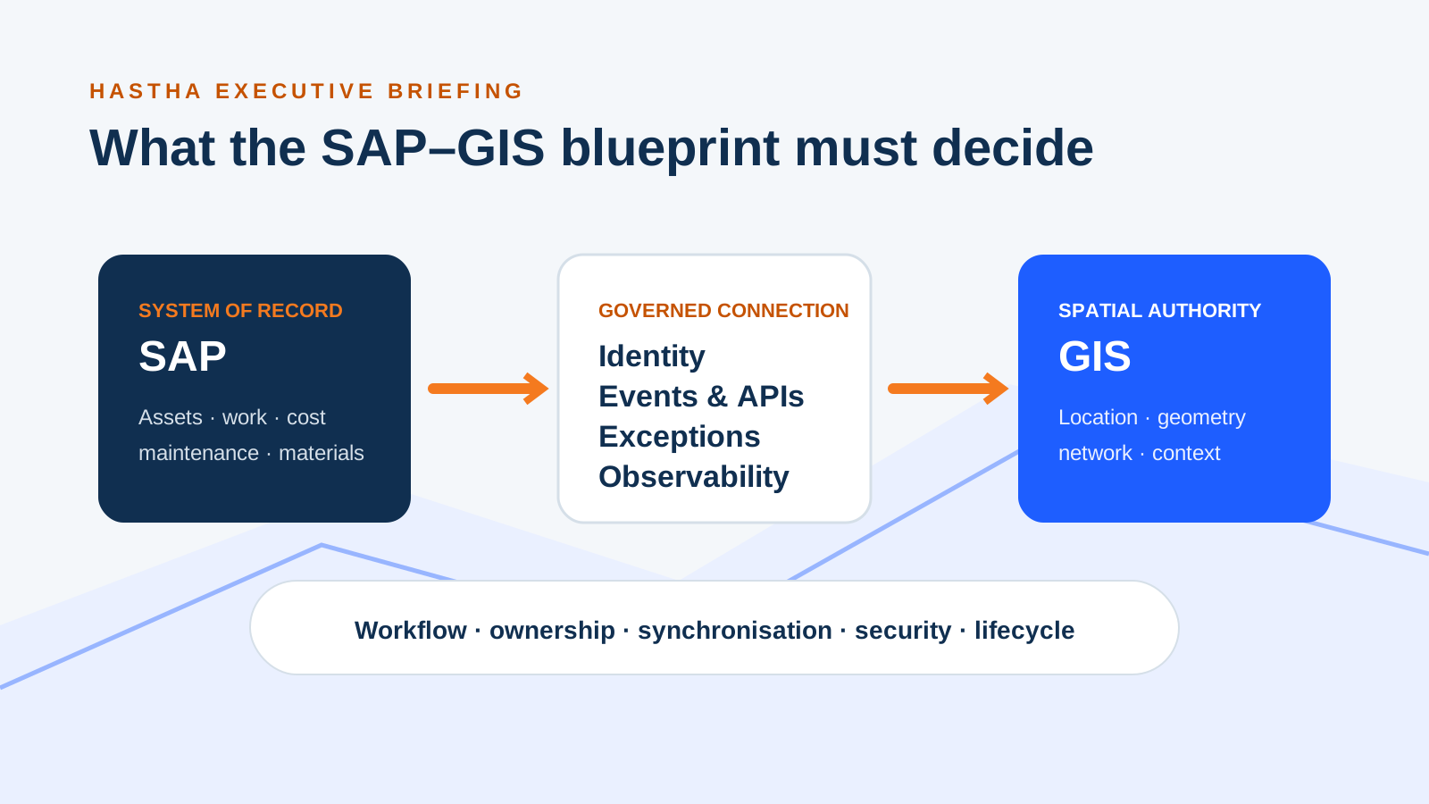
The cover diagram illustrates one integration pattern: SAP manages maintenance work, cost and materials; GIS manages geometry and network context. Confirm the authoritative source for each asset attribute and lifecycle change before designing the connection. The integration coordinates identifiers, updates and error handling.
Across all three layers, the blueprint must resolve workflow, ownership, synchronisation, security and lifecycle decisions. The following sections explain each decision in detail.
SAP: assets, maintenance work, cost and materials.
Governed connection: identity, events and APIs, exceptions and observability.
GIS: location, geometry, network and spatial context.
Cross-cutting decisions: workflow, ownership, synchronisation, security and lifecycle.
Begin with operational workflows, not interface fields
The blueprint should start with people and decisions: a planner locating work, an inspector creating a defect, a controller understanding network impact, a crew navigating to an asset, or an engineer assessing condition along a corridor. For each workflow, document the trigger, user, systems touched, evidence created and required response time.
This prevents a common failure mode: building a broad data synchronisation layer before agreeing what the business must do. Once priority workflows are clear, the team can distinguish data required in real time from data suitable for scheduled synchronisation or on-demand retrieval.
Assign authoritative ownership field by field
“SAP owns assets and GIS owns location” is too coarse. Ownership may vary by asset class and attribute. SAP may own maintenance status and equipment identity; GIS may own geometry, topology and linear referencing; another platform may own engineering documents or sensor observations. The blueprint should record the authoritative source, steward and allowed update path for each important information group.
Ownership must include lifecycle events. Define what happens when an asset is proposed, commissioned, moved, split, merged, retired or temporarily unavailable. Without these rules, apparently simple synchronisation produces duplicate identifiers, orphaned geometry and competing histories.
Stable enterprise identifier and cross-reference strategy
Authoritative source for geometry, hierarchy, status and descriptive attributes
Creation, change and retirement responsibilities
Validation, exception and stewardship workflow
Choose integration patterns by business tolerance
Not every interaction needs bidirectional real-time integration. A map used for morning planning may tolerate a short delay. A safety or network-isolation decision may not. Classify exchanges by latency, volume, criticality and recovery requirement, then select APIs, events, queues, replication or federated queries accordingly.
The blueprint should also define idempotency, retries, ordering, reconciliation and observability. Teams need to know how a failed update is detected, who owns the queue, how records are replayed and how business users see that information is stale. Integration that works only when every component is healthy is not an operational design.
Design the spatial identity and linear-reference model
Roads, rail, pipelines and utilities add complexity because work may refer to a point, segment, route, offset or changing network measure. The enterprise identity must survive reasonable geometry edits and network recalibration. Otherwise history becomes tied to a drawing rather than the enduring asset or location concept.
Agree how route identifiers, measures, coordinate systems, topology and segmentation relate to SAP functional locations, equipment and linear data. Include rules for translating between geographic coordinates and business chainage or measure. These decisions determine whether planners can trust a spatial view of work over time.
Include field and offline behaviour in the blueprint
Field users frequently need asset, map, work and content information together. The blueprint should state what is packaged to the device, what remains online, how areas or assignments are selected, how edits are queued and how conflicts are resolved. Map performance, device storage and background synchronisation are operational requirements, not interface polish.
Security must travel with the data. Define least-privilege access, sensitive layers, offline retention, device controls and audit evidence. A disconnected device is still part of the enterprise information boundary.
Make the blueprint executable
A useful deliverable includes prioritised workflows, context diagrams, system responsibilities, information contracts, interface patterns, non-functional requirements, security controls, failure scenarios, governance decisions and a staged delivery path. It should identify assumptions to prove early and decisions that can safely wait.
The test of the blueprint is whether a product owner, architect, integration developer, GIS specialist and SAP functional lead can use it to make consistent decisions. When they can, SAP and GIS become one operational capability rather than two connected silos.